Thursday, July 31, 2014

Charlottetown, PEI to Havre Boucher, NS to Bras d'Or, NS July 26--31

    We got underway shortly after 0500 from Charlottetown after being rocked awake at 0300 by a large cargo ship passing by the marina.  Our traveling companions soon discovered their engine to be running roughly, and asked us to continue while they circled back to the dock.  They later solved the issue and followed us.  We cleared the Charlottetown entrance, ran along the north (PEI) shore of the Northumberland Strait for awhile, and then crossed east of Pictou Island over to the south shore, passing Cape George and entering St. George’s Bay about 1400.  We were moving so well, and the day was so good weather-wise, that we crossed to the southeast corner of the bay and anchored in Havre Boucher.  This was a quiet, protected spot and allowed close access to the Strait of Canso, which we entered about 0820 the following morning. 
     We moved south to where the Canso Causeway, a rock-based two-lane causeway crosses the strait, and entered the lock.  There was only mild wind, so we were allowed to hover in the middle of this large lock until we were lowered, and the causeway bridge across the south end of the lock was opened.  We then departed, traveling along the remainder of the Strait of Canso until our departure eastward into Lennox Passage.   Since it had been overcast all morning, the temperature was not too high for the Burnt Island Bridge to lift, and we proceeded on to St. Peter Canal.  We entered the St. Peter Lock about 1300, and after departing it the lockmasters drove ahead to open the swing bridge which allowed us to pass into the Bras d’Or Lakes about 1400.  These “lakes”, nestled in the heart of Cape Breton Island, have some of the prettiest scenery in Canada.  We traveled up the lake about seven miles before settling on an anchorage for the evening.   Our anchorage in Damion’s cove was a little less protected than ideal, and so the next day in anticipation of rough weather we moved around the corner to an anchorage at Cape George Harbour.  It was a beautiful spot, and much better protected when the major winds and rain came that night.  The following day we moved back down the lakes to St. Peter’s Marina where I repaired their Wi-Fi for them, and then toured beautiful Cape Breton Island by car.
     There were some stunning vistas on the Cabot Trail drive, but many seaside views have been overgrown by trees and therefore limited.  We rode a cable ferry, and stopped at the quaint village of Baddeck to tour the Alexander Graham Bell museum.  Baddeck was the location of a great deal of his post-telephone research, and here his team developed an airplane and a hover-craft, both shown below.  Also in the photos are some interesting items…miniature (by Texas standards) pine cones and a couple of bookstands…at least I suppose that is what they are.  They are present everywhere in Canada with large tomes hanging from them.  I never see anyone reading the books, though…???


Between Sea and Sky--Summerside

Confederation Causeway, PEI to NB

Cape St. George

Cape St. George Light

Canso Causeway to Cape Breton I.

Canso Lock & Bridge

Burnt Island Bridge, NS

St. Peter's Light, NS

St. Peter, NS

Bras d'Or Lakes, Cape Breton Island

St. Peter's Marina, NS

Cape Breton Island, NS

On the Cabot Trail

Baddeck, NS

HD-4 Hydrofoil, 70 mph, 1917

Silver Dart, 800 meter flight, 1909

"Miniature" Pine Cones?

What Are These Relics?


Wednesday, July 23, 2014

Chandler, QC to Miramichi Bay, NB to Summerside, PEI July 21--24

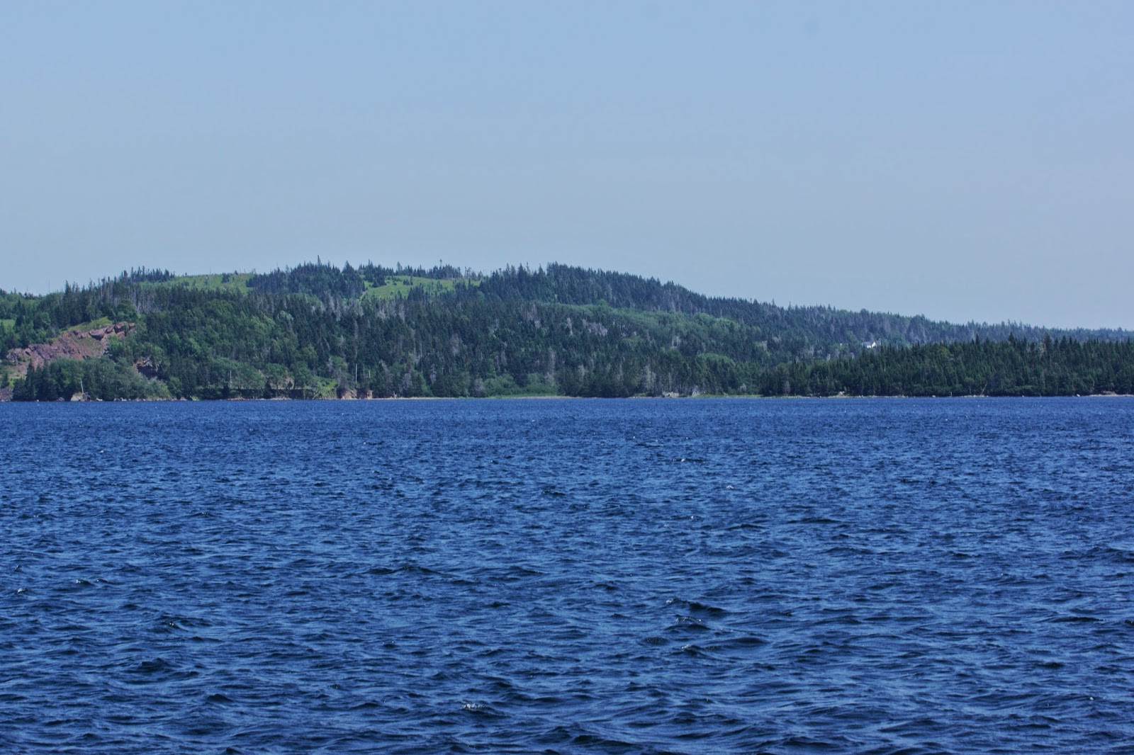
We gladly departed the very cramped marina in Chandler in the province of Quebec about 0500, grateful that the wind had not risen and we had therefore not carried away their tenuous dock.  It took a bit of my analytical planning and understanding of the physics of moving boats to extricate Spirit Journey from its docking position, but this was accomplished in a mere 10 minutes without difficulty.  Texas Ranger then left its dock and led the 90-mile trek across the Bay of Chaleur, around Miscou Island, and down the coast of the province of New Brunswick to an anchorage behind Portage Island in Miramichi Bay.  We likely would have ventured farther south the following day to the town of Miramichi, but a forecast of rough weather in a couple of days suggested that the wiser course was another long day across the Northumberland Strait to Summerside in Prince Edward Island province, Canada's smallest province.  We are now in the Atlantic time zone.
     The dirt on Prince Edward Island is quite red, and the town is large enough to have just about anything needed.  The marina is nice, but they asked us to sandwich into a dock space with about 15 feet more than our combined lengths.  I am the envy of the local yacht club, as a couple of dozen "witnesses" watched with their jaws agape as I backed/parallel parked as the second boat in.  We will spend about 3 nights here until the front has passed (it is blowing 30 knots ahead of the front).  One unique attribute of the town is the College of Piping and Celtic Performing Arts of Canada.  We attended an early afternoon sampling of their presentation, which will be much more elaborate in the evening.  Given the distance to walk back and the cost, the sampling will likely suffice.  En route back to the boat, I toured an old machine shop with many of the belt-driven tools used in that shop and its foundry for nearly 100 years. 

More Seals

Prince Edward Island

College of Piping

Snare Drummer

Piper

College of Piping

Old Summerside Machine Shop

Tight Fit

Gaspe, QC to Chandler, QC July 20, 2014

We had a beautiful day to cruise from Gaspe to Chandler in the Bay of Chaleur.  This route passes a couple of Canada’s most famous landmarks:  Perce Rock and Ile Bonaventure.  The former is an incredibly stunning rock with an 18-meter hole through it, and the latter is home to the largest colony of gannets in the Atlantic with over 50,000 birds.  In total, some 250,000 total seabirds nest on Ile Bonaventure.  While the gannets gracefully soar or skim above the surface, their landings are less refined...more of a controlled crash, chest-first, into the water.  Of course, whales and seals are abundant as well.  We docked in a “too small” marina in Chandler, QC, up the Bay of Chaleur, but there were no other alternatives or suitable anchorages nearby.  The members of the local yacht club were friendly, helpful and accommodating.  Some of the most striking scenes of our travels were witnessed today!

Rocher Perce

Will It Fit?  (the answer is "no")

Rocher Perce

From the Other Side

Rocher Perce

Gannet

Seal

All of the "White Dots" Are Gannets

Gannet

Gannet

Saturday, July 19, 2014

Riviere-au-Renard to Gaspe, QC July 18--19


We had a delightful run along the last stretch of the Gaspe Peninsula.  We passed the tallest lighthouse in Canada (structure, not height above the water) at Cap-des-Rosier…34 meters.  It was built in 1858, and the walls are 2.13 meters thick at the base, and 0.9 meters thick at the top.  Passing the rugged cliffs of Cap-de-Gaspe was yet another reminder of the words of the hymn, “How Great Thou Art”.  The Creator of such grandeur is truly Lord of the universe!  We have been almost constantly reminded of that on this trip.  We rounded Cap-de-Gaspe, and ran up the Baie-de-Gaspe to the town of the same name.  There were some whales in the bay, and a cross in the city commemorates the site (according to this chamber of commerce) where Jacques Cartier claimed North America for Le Roi (the king) of France in 1534.  A great deal of the history of this town in the last century or two revolves around English immigrants, and so that language is far more prevalent here than in the rest of Quebec.  The large boat dock that we used outside the marina harbor was superb…by far the highest quality dock that we have seen in quite some time.  The marina is recovering from a fire in its office last winter, and some services are not yet restored, but the dock is nice.  We walked into town for dinner, and visited a number of their shops.  We move on shortly for New Brunswick and the Atlantic time zone!  The first few stops will likely be pretty remote before we get into the Northumberland Strait and to Prince Edward Island.
 
 
Cap-des-Rosier Lighthouse

Gaspe Peninsula

Cap-de-Gaspe From Outside

Cap-de-Gaspe

Cap-de-Gaspe From Inside

Town of Gaspe

Cross Commemorating Jacques Cartier
 

Friday, July 18, 2014

Anse-Saint-Jean to Rimouski to Saint-Anne-des-Monts to Riviere-au-Renard, QC July 15--17

     The marina at Tadoussac was full, and so we stayed a third night in Anse-Saint-Jean.  We left that dock at 0300 (there was even a little daylight visible over the mountains as we left the cove), and cruised down the Saguenay Fjord to Tadoussac.  Along the way we saw a few belugas and one or two other whales and seals, and crossed into the St. Lawrence River a little after 0600.  We crossed diagonally to the south shore, and about 1300 arrived at Rimouski.  After docking and looking around, we hiked to the grocery store and carried back a full load.  Rimouski is famous as the site of the sinking of The Empress of Ireland, a large passenger liner, in May, 1914…just two years after the sinking of the Titanic.  On a foggy night the ship left off mail in Rimouski, and was shortly thereafter struck midship by the Norwegian coal ship Storstad which was carrying 1100 tons of coal.  Originally an icebreaker, Storstad penetrated 35 feet into the hull of the Empress.  Over 1000 people drowned.  The next day we departed at 0500 for a 90-mile day along the Gaspe Peninsula to Saint- Anne-des-Monts.  The wind had the river kicked up a bit, and it was misty and somewhat foggy most of the day.  We did see a large whale along the way, and docked in a decrepit marina about 1800.  There was no electricity that we could use (only a 15 amp electrical cord), and the dock was too short for both boats to fully tie up.  The harbor, however, was well-protected, and with a cold front predicted, that was the important issue. 

The front blew through about 0300, and about 0530 we were off again for a second 90-mile day.  The wind was quite strong, but since it was from aft, the ride was not bad.  We passed a number of interesting villages, and without the fog we could actually see them.  One of the landmarks we passed was a lighthouse and its outbuildings at Pointe-a-la-Renommee which was the site of the first North American maritime radio station, installed by Marconi in 1904.  Another significant location was the northernmost point on our travels…at 1030 we passed latitude 49 degrees, 16.080 minutes.  Thereafter, we will be returning (though quite slowly and obliquely) south.  At about 1730 we arrived and docked in the delightful harbor at Riviere-au-Renard.  Though little English is spoken, when the lady in the marina office found out I am from Texas, she pulled up her jeans to show off her boots, put on her cowboy hat, and turned on a Johnny Cash CD!  On a hill above the town lies the site at which Jacques Cartier first claimed North America for France in 1534, and a church and cross mark the location of this historic event.  Tomorrow we will have a shorter day, rounding the tip of the Gaspe Peninsula and visiting the town of Gaspe.  The mountainous terrain dropping into the huge Saint Lawrence will soon thereafter give way to the lower topography of New Brunswick, and the common language will also soon revert to English.
 
Low Clouds on the St. Lawrence

Long Days...Everyone Needs a Rest

Typical Riverfront Village

Crowded In At Saint-Anne-des-Monts

Saint-Anne-des-Monts

Typical Gaspe Peninsula Topography

Gaspe Peninsula

Northernmost Point of Our Travels

First N.A. Maritime Radio Station 1904

Riviere-au-Renard


Jacques Cartier Claimed N.A. For France